Artificial Intelligence
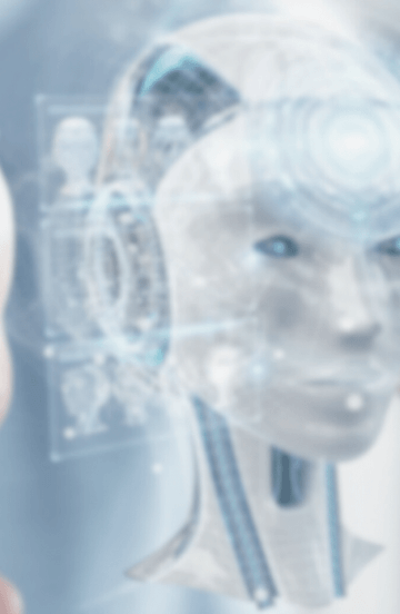
Mit Künstlicher Intelligenz (KI) können bisher ungelöste komplexe Fragestellungen auf vielfältige Weise beantwortet werden. Die RISC Software GmbH unterstützt Ihr Unternehmen bei der Anwendung von KI.


Seit der Gründung im Jahr 1992 durch Prof. Bruno Buchberger forscht und entwickelt die RISC Software GmbH für die Wirtschaft. Dabei werden in einzigartiger Weise die Kernkompetenzen Symbolisches Rechnen, Mathematik und Informatik im Rahmen der Geschäftsbereiche Logistik-Informatik, Industrielle Softwareanwendungen, Medizin-Informatik und Domänenspezifische Applikationen zur Entwicklung praxisgerechter Softwarelösungen eingesetzt.
Die Zusammenarbeit mit der RISC Software GmbH in den Projekten VPA 4.0 und Boost 4.0 hat die Wichtigkeit unseres wachsenden Digitalisierungsprozesses verdeutlicht und dazu beigetragen diesen weiterhin auszubauen um die Qualität unserer Maschinen laufend zu verbessern.

Im Zuge unserer langjährigen Kooperation wurde in enger Zusammenarbeit mit der RISC Software GmbH eine umfassende Simulation als CAM Lösung für WFL Maschinen entwickelt.

Es ist großartig, dass wir dieses Leitprojekt in Oberösterreich haben. MEDUSA katapultiert uns in Forschung und Entwicklung ganz nach vorne.

Gemeinsam mit der RISC Software GmbH Teil des Leitprojektes MEDUSA zu sein, macht uns extrem stolz. Die Expertise aller RISC-Mitarbeiter*innen zeigt, welch großes Potenzial in der Digitalisierung sowohl für den medizinischen/klinischen Bereich als auch für die Medizintechnik-Welt steckt.

Ich darf seit einigen Jahren im Forschungsprojekt MEDUSA mitarbeiten. Das Projekt wird zum einen von RISC koordiniert (Michael Giretzlehner, Isabell Ganitzer) und zum anderen vom RISC-Team rund um die technische Innovation begleitet. Ich darf hiermit meine uneingeschränkte Hochachtung vor den Leistungen des gesamten Teams aussprechen. Es ist mir eine Ehre, mit euch arbeiten zu dürfen!

Eine Zusammenarbeit, die schon unmittelbar nach der Gründung der RISC Software GmbH begann, setzt sich erfolgreich bis heute fort. RISC hat uns bisher vor allem bei Fragestellungen aus dem Bereich der Digitalisierung unserer umfangreichen und kritischen Logistikprozesse sehr gut beraten und zu deren Lösung passgenaue Software geliefert. Die pragmatische, agile Vorgehensweise kommt dabei unserer eigenen Arbeitsweise sehr entgegen.

Seit mehr als 20 Jahren ist die RISC Software GmbH unser zuverlässiger Partner, mit dem wir schon viele Projekte und Weiterentwicklungen unserer Systeme gemeinsam erfolgreich realisieren konnten.

Die RISC Software GmbH ist ein herausragender Partner für die Entwicklung unserer neuen Schalungsplanungssoftware!
Die direkte Zusammenarbeit im Backend, die Unterstützung in agilen Arbeitsmethoden und schnelle Umsetzung von Anforderungen in der Weboberfläche ermöglichen eine äußerst produktive Softwareentwicklung.

Es sollte die Verwaltung unserer Supply-Chain-Optimierungsszenarien neu aufgesetzt werden.
RISC Software hat den Konzeptionsprozess professionell und agil begleitet und gemeinsam mit der internen IT der voestalpine Stahl GmbH innerhalb kurzer Zeit eine sehr zufriedenstellende Lösung erarbeitet und ausgeliefert.


Mit Künstlicher Intelligenz (KI) können bisher ungelöste komplexe Fragestellungen auf vielfältige Weise beantwortet werden. Die RISC Software GmbH unterstützt Ihr Unternehmen bei der Anwendung von KI.

Entdecken Sie die Möglichkeiten der Simulation, Optimierung und Prognose für Produktion und Industrie und profitieren Sie vom effizienteren Einsatz von Ressourcen sowie von höherer Produktionsqualität und -effizienz.

Mit smarten Technologien aus den Bereichen Data Engineering und Künstliche Intelligenz unterstützt die RISC Software GmbH Unternehmen bei der effizienten Verarbeitung und Analyse von Daten, Texten und Bildern.

Die RISC Software GmbH hilft Ihnen bei der Entwicklung individueller Lösungen durch tiefgreifendes Know-how über geometrische Modellierung sowohl in der industriellen Fertigung als auch für medizinische Anwendungsfälle.

Die RISC Software GmbH unterstützt Sie bei der Entwicklung maßgeschneiderter Softwarelösungen zur Etablierung von holistischen digitalen Zwillingen für die virtuelle Produktentwicklung und für Produktionsprozesse.

Digitale Produkte, so individuell wie Ihr Business! Die RISC Software GmbH ist Ihre effiziente Umsetzungspartnerin, wenn es um effektive Softwarelösungen geht. Von der Idee über die Umsetzung, das Rollout und die Weiterentwicklung steht sie Ihnen langfristig zur Seite.
Wir fusionieren seit mehr als 30 Jahren Software Engineering, Mathematik, Agilität, Forschung und Technologie zu einem einzigartigen Gesamtpaket. Als außeruniversitäre Forschungseinrichtung arbeiten wir nicht für den maximalen finanziellen Gewinn, sondern wollen unseren Teil zu einer besseren Welt beitragen. Von grundlagennaher Forschung für Start-Ups, anwendungsorientierter Forschung & Entwicklung und langjährigen Engineering Projekte für internationale Konzerne bieten wir ein breites Aufgabenfeld für unsere Mitarbeiter*innen.